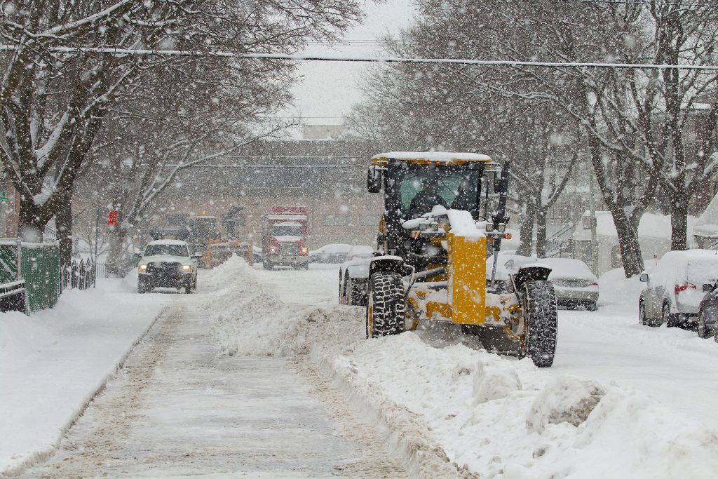
Heavy Snowfall, Freezing Rain, and Hazardous Travel Conditions Forecasted
Southern Ontario is bracing for what could be the biggest snowstorm of the season, as Environment and Climate Change Canada issues special weather statements and watches across the region. The storm is expected to bring significant snowfall, freezing rain, and poor visibility beginning Wednesday evening and lasting into Thursday.
- Greater Toronto Area (GTA) & Southern Ontario – Up to 15 cm of snow expected.
- Windsor & Southwestern Ontario – Up to 10 cm of snow.
- North of the GTA (Barrie, Muskoka, Peterborough) – 20 to 40 cm of total snowfall.
- Additional Hazards – Blowing snow, poor visibility, and possible freezing rain in some areas.
The low-pressure system is expected to arrive Wednesday evening and continue through Thursday, bringing heavy snowfall and hazardous travel conditions. Environment Canada warns that some areas may see a transition to freezing rain or rain overnight, depending on the storm’s exact path.
“If the system tracks farther south, precipitation will remain predominantly snow, potentially leading to even higher snowfall totals,” Environment Canada stated in an update.
Authorities are urging residents to postpone non-essential travel as road conditions will deteriorate quickly, particularly Wednesday evening into Thursday morning.
Toronto Pearson Airport is closely monitoring the storm, with Airfield and Deicing crews preparing to keep operations running.
“We’re continuing to track what could be the biggest snowstorm of the season at Pearson,” officials stated on X. “With 161 pieces of state-of-the-art equipment, our teams are ready to tackle the snow and keep planes moving safely.”
Residents are advised to:
- Monitor weather updates and alerts from Environment Canada.
- Avoid non-essential travel, as road conditions may become dangerous.
- Prepare for potential power outages in areas experiencing freezing rain.
- Stock up on essentials ahead of the storm.