Canada’s fall season is off to a dramatic start with record-breaking heat in British Columbia and early cold snaps in Central and Eastern Canada, but forecasters say the weeks ahead will bring milder conditions before an abrupt shift to winter.
The Weather Network’s seasonal outlook predicts warmer-than-normal temperatures and fewer storms across much of the country from mid-September through October, giving Canadians extended stretches of pleasant weather to enjoy fall foliage and outdoor activities. “In the temperature roller-coaster that’s normal with the season, the milder periods will outweigh the periods of cooler weather,” explained senior meteorologist Doug Gillham.
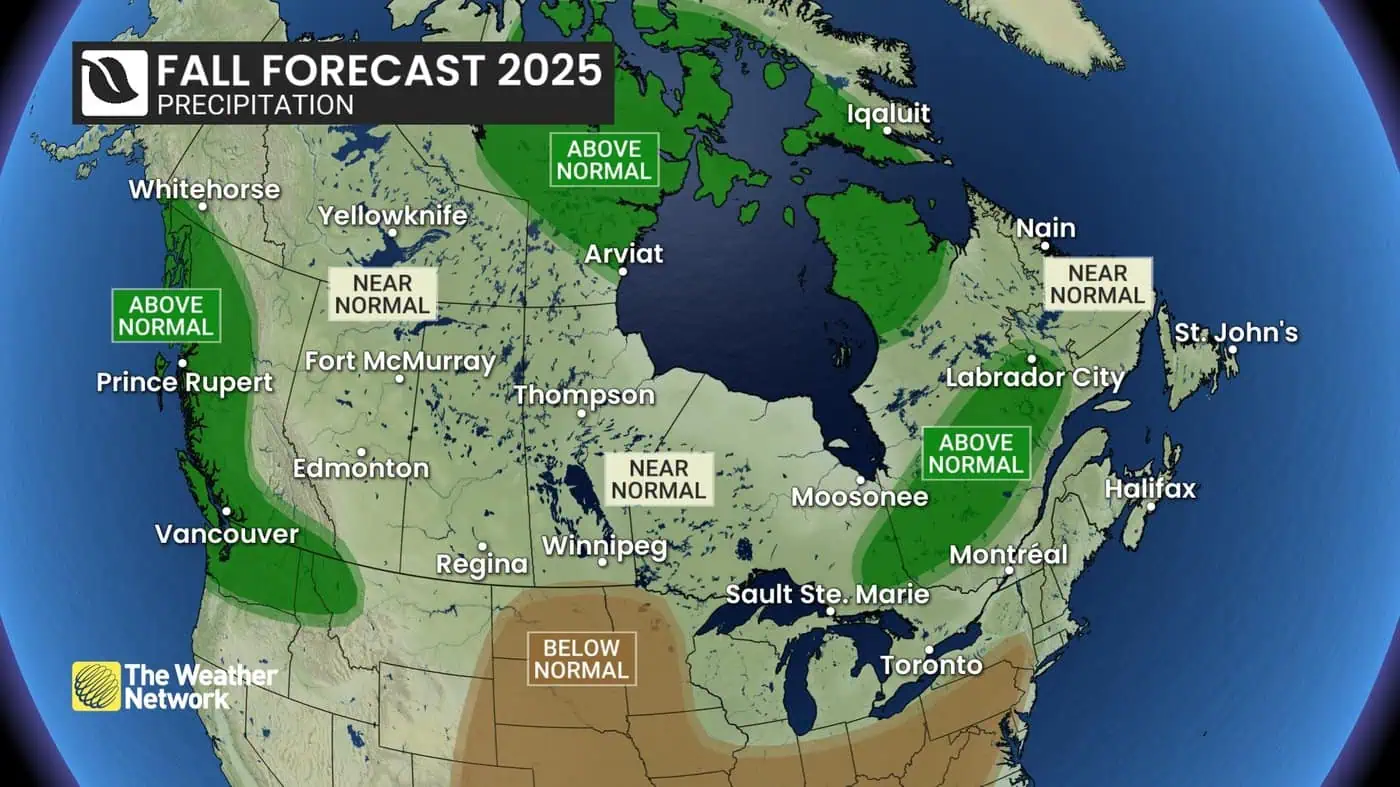
However, by November, the forecast suggests storm activity will ramp up and arctic air will return, setting the stage for a more active and colder pattern. Most of Canada is expected to see precipitation levels near normal, with slightly wetter conditions likely for northern Canada, the B.C. coast, and northeastern Ontario through to central Quebec and Labrador. Atlantic Canada remains the “wild card,” with an unusually dry year so far but the potential for late-season tropical systems to bring heavy rain.
Ontario, Quebec, and the Prairies are all expected to experience warmer-than-usual stretches before November storms usher in a wintry pattern. Western Canada will still face wildfire smoke risks until the rainy season fully begins, while the Pacific coast could see above-normal rainfall fueled by warm northern Pacific waters.
Gillham cautioned that the jet stream will eventually push southward, carrying more cold air with it. “We can’t hold off the season forever,” he said.
Climate data shows the average autumn temperature across Canada has risen 2.4°C since 1948, underscoring the influence of climate change on shifting weather patterns.