Winter weather swept across large parts of Ontario and the rest of the country Thursday, with Environment Canada issuing multiple advisories and warnings as heavy snow, strong winds and dangerous travel conditions take hold.
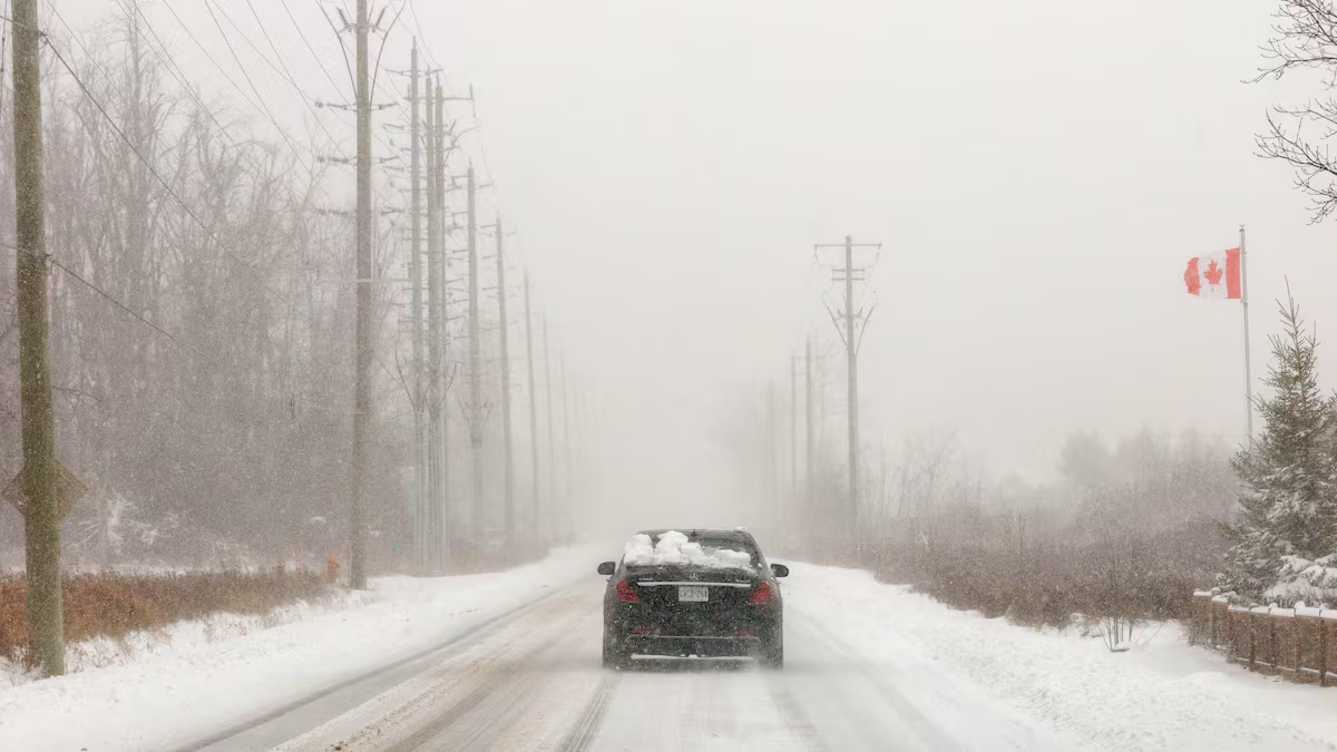
Snow squall warnings remain in effect for a broad swath of southwestern and central Ontario, stretching from Lindsay to Grand Bend and north toward Tobermory and Manitoulin Island. Environment Canada says squalls coming off Lake Huron and Georgian Bay will sharply reduce visibility and lead to rapid snow accumulation, with some areas expected to receive up to 50 centimetres by day’s end.
Northwesterly winds gusting between 50 and 60 km/h are expected to intensify blowing snow and further impair visibility. Conditions may vary widely from one community to another, Environment Canada cautioned, adding that improvements are expected later this evening.
In southern Quebec, winter weather travel advisories cover a significant area along the south shore of the St. Lawrence River from the Ontario border past Quebec City. Heavy flurries could drop visibility to near zero, posing major hazards for drivers during the morning and evening rush hours.
The storm system is also affecting regions beyond Ontario and Quebec. Snow squall watches are in effect for parts of the Maritimes, including western Cape Breton and Newfoundland’s southwest coast, where conditions are expected to worsen Thursday night into Friday. Central New Brunswick is facing extreme cold warnings, with temperatures forecast to plunge below –30°C overnight.
Further west, Alberta is dealing with its own snowfall warnings northwest of Edmonton, where as much as 20 centimetres of snow is expected. In British Columbia, freezing rain warnings have been issued for the 100 Mile House and Watson Lake regions, prompting concerns about slippery and hazardous road conditions.
Environment Canada is urging Canadians in affected regions to monitor local forecasts closely and prepare for sudden weather changes, reduced visibility and dangerous travel conditions as the winter system continues to sweep across the country.