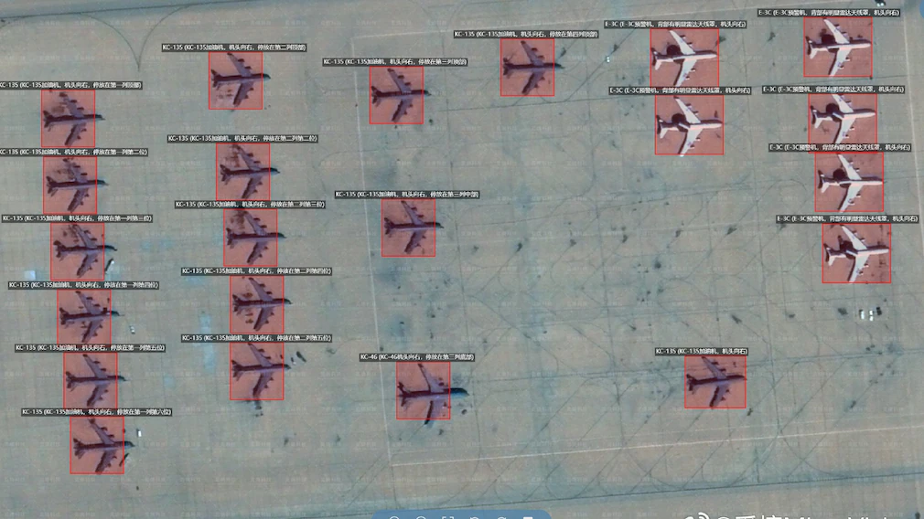
Satellite images circulated online days before the outbreak of the Iran conflict appear to have revealed significant movements of American military assets across the Middle East, raising new questions about how open-source intelligence and artificial intelligence are reshaping modern warfare. In the final week of February, a series of high-resolution satellite images began appearing on social media showing aircraft deployments, naval activity and troop movements at several military bases in the region. The images were annotated in Mandarin and included detailed identification of aircraft, missile defence systems and other military equipment. Analysts say the imagery was shared by MizarVision, a Chinese company that specializes in combining satellite imagery with artificial intelligence to analyze military activity.
The images reportedly showed U.S. fighter aircraft and support systems stationed at bases across the Middle East, including Ovda Air Base in Israel and Prince Sultan Air Base. Satellite photos also highlighted activity at Al Udeid Air Base and other installations in countries such as Jordan, Kuwait and Bahrain. Among the aircraft reportedly identified were several F-22 Raptor fighters positioned at Ovda shortly before combat operations began. Just days later, on Feb. 28, the United States and Israel launched a joint military campaign known as Operation Epic Fury targeting sites in Iran.
The company also tracked naval movements, publishing satellite images that appeared to show the USS Gerald R. Ford departing a naval base in Crete with fighter jets visible on its flight deck, as well as activity involving the USS Abraham Lincoln operating in waters near Oman. Analysts say the firm combined satellite imagery with publicly available aircraft and ship tracking data, allowing observers to monitor the movements of reconnaissance aircraft and naval vessels across the region.
Unlike major satellite operators that own large constellations of imaging satellites, MizarVision is primarily an analytics company that compiles and processes publicly available data from multiple sources. Experts say the company uses artificial intelligence to identify military hardware automatically in satellite imagery, effectively creating a type of geospatial intelligence product similar to what national intelligence agencies produce. The imagery used in the analysis may have come from China’s Jilin-1 satellite constellation or from commercial Western satellite providers that sell imagery globally.
There is no confirmed evidence that the information was used directly by Iranian forces during the conflict. However, some of the facilities highlighted in the images were later targeted in missile and drone attacks launched by Iran, including installations in Qatar and Jordan. One strike reportedly destroyed a sophisticated missile-defence radar system used to help guide U.S. interception efforts in the region. Analysts say the episode highlights how widely available satellite imagery, combined with powerful AI tools, is making it increasingly possible for private companies and independent analysts to monitor military deployments around the world in near real time.